
ಫೈಲ್:USA California location map.svg

Size of this PNG preview of this SVG file: ೫೨೩ × ೫೯೯ ಚಿತ್ರೊ ಬಿಂದುಲು. ಬೇತೆಪಟೊತ್ತ ಗಾತ್ರೊ: ೨೦೯ × ೨೪೦ ಚಿತ್ರೊ ಬಿಂದುಲು | ೪೧೯ × ೪೮೦ ಚಿತ್ರೊ ಬಿಂದುಲು | ೬೭೦ × ೭೬೮ ಚಿತ್ರೊ ಬಿಂದುಲು | ೮೯೪ × ೧,೦೨೪ ಚಿತ್ರೊ ಬಿಂದುಲು | ೧,೭೮೭ × ೨,೦೪೮ ಚಿತ್ರೊ ಬಿಂದುಲು | ೧,೦೨೨ × ೧,೧೭೧ ಚಿತ್ರೊ ಬಿಂದುಲು.
ಮೂಲೊ ಫೈಲ್ (ಎಸ್.ವಿ.ಜಿ ಫೈಲ್, ಸುಮಾರಾದ್ ೧,೦೨೨ × ೧,೧೭೧ ಚಿತ್ರೊಬಿಂದು, ಫೈಲ್ದ ಗಾತ್ರ: ೪೮೦ KB)
ಸಾರಾಂಸೊ
| ವಿವರಣೆ |
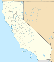
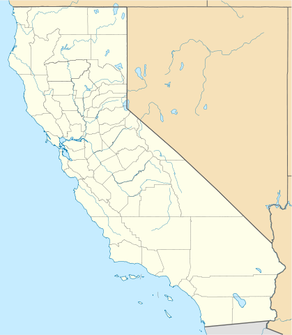
Quadratische Plattkarte, N-S-Streckung 125 %. Geographische Begrenzung der Karte:
Equirectangular projection, N/S stretching 125 %. Geographic limits of the map:
|
||
| ದಿನೊ | |||
| ಮೂಲೊ |
ಸೊಂತೊ ರಚನೆ
|
||
| ಲೇಕಕೆರ್ | NordNordWest | ||
| ಇತರೆ ಆವೃತ್ತಿಗಳು |
Derivative works of this file: |
||
| SVG genesis |
|

ಪರವಾನಿಗೆ
I, the copyright holder of this work, hereby publish it under the following licenses:

|
ಈ ಲೇಕನೊನು ಫ್ರೀ ಸಾಫ್ಟ್ವೇರ್ ಫೌಂಡೇಶನ್ಡ್ದ್ ಪ್ರಕಟನೆ ಆಯಿನ ಜಿಎನ್ಯು ಫ್ರೀ ಡಾಕ್ಯುಮೆಂಟೇಶನ್ ಲೈಸೆನ್ಸ್, ಆವೃತ್ತಿ 1.2 ಅತ್ತ್ಡ ಬೊಕ್ಕ ಪ್ರಕಟನೆ ಆಯಿನ ಒವ್ವೇ ಆವೃತ್ತಿದ ನಿಬಂದನೆದಡಿಟ್; ಬದಲ್ ಮಲ್ಪೆರಾವಂದಿನ ವಿಬಾಗೊಲು ದಾಂತೆ, ಫ್ರಂಟ್-ಕವರ್ ಬರವು ದಾಂತೆ, ಬೊಕ್ಕ ಬ್ಯಾಕ್-ಕವರ್ ಬರವು ದಾಂತೆ; ನಕಲ್ ಮಲ್ಪೆರೆ, ವಿತರಣೆ ಮಲ್ಪೆರೆ ಅತ್ತ್ಡ ಬದಲ್ ಮಲ್ಪೆರೆ ಒಪ್ಪಿಗೆ ಉಂಡು. ಈ ಲೈಸೆನ್ಸ್ದ ಒಂಜಿ ಪ್ರತಿ ಜಿಎನ್ಯು ಫ್ರೀ ಡಾಕ್ಯುಮೆಂಟೇಶನ್ ಲೈಸೆನ್ಸ್ ಪನ್ಪಿ ವಿಬಾಗೊಡು ಉಂಡು. |
This file is licensed under the Creative Commons Attribution 3.0 Unported license.
- ಇರೆಗ್ ಸೊಸಂತ್ರೊ ಉಂಡು:
- ಪಟ್ಯರಗ್ – ಬೇಲೆನ್ ನಕಲ್, ವಿತರಣೆ ಮಲ್ಪೆರೆ ಬೊಕ್ಕ ಸಾಗಾಯೆರೆ
- ಮಿಸ್ರೊ ಮಲ್ಪೆರೆ – ಈ ಬೇಲೆನ್ ಗಲಸೊನಿಯೆರೆ
- ಈ ತಿರ್ತ್ದ ಸರತ್ತುಲೆಡ್:
- ಕೃಪೆ – ಲೇಕಕೆರ್ ಅತ್ತಂಡ ಲೈಸನ್ಸರ್ ವ್ಯಕ್ತೊ ಮಲ್ತಿನ ರೀತಿಡ್ ಲೇಕನೊದ ಶ್ರೇಯೊನು (ಕ್ರೆಡಿಟ್) ಅರೆಗ್ ಕೊರೊಡು .(ಆಂಡ ಇರೆನ್ ಅತ್ತಂಡ ಈರ್ ಲೇಕನೊನು ಗಲಸಿನೇನ್ ಆರ್ ಸಮರ್ಥನೆ ಮಲ್ತಿಲೆಕೊ ತೊಜಪಾವುನ ರೀತಿಡ್ ಅತ್ತ್).
ಈರೆನ ಇಷ್ಟೊದ ಪರವಾನಿಗೆನ್ ಈರ್ ಆಯ್ಕೆ ಮಲ್ತೊನೊಲಿ
ಫೈಲ್ದ ಇತಿಹಾಸೊ
ದಿನೊ/ಪೊರ್ತುದ ಮಿತ್ತ್ ಒತ್ತ್ಂಡ ಫೈಲ್ ಆ ಪೊರ್ತುಡು ಎಂಚ ತೋಜೊಂದಿತ್ತ್ಂಡ್ ಪಂದ್ ತೂವೊಲಿ.
| ದಿನೊ/ಪೊರ್ತು | ಎಲ್ಯಚಿತ್ರೊ | ಆಯಾಮೊಲು | ಬಳಕೆದಾರೆರ್ | ಅಬಿಪ್ರಾಯೊ | |
|---|---|---|---|---|---|
| ಇತ್ತೆದ | ೦೦:೪೭, ೬ ಜೂನ್ ೨೦೦೯ | | ೧,೦೨೨ × ೧,೧೭೧ (೪೮೦ KB) | NordNordWest | more detailed |
| ೦೩:೨೦, ೧೩ ಮಾರ್ಚಿ ೨೦೦೯ |  | ೧,೦೨೦ × ೧,೧೬೯ (೩೮೫ KB) | NordNordWest | {{Information |Description= {{de|Positionskarte von Kalifornien, USA}} Quadratische Plattkarte, N-S-Streckung 125 %. Geographische Begrenzung der Karte: * N: 42.2° N * S: 32.3° N * W: 124.7° W * O: 113.9° W {{en|Locatio |
ಫೈಲ್ದ ಉಪಯೋಗ
ಈ ತಿರ್ತ್ದ 2 ಪುಟೊಕುಲು ಈ ಫೈಲ್ಗ್ ಸಂಪರ್ಕೊ ಕೊರ್ಪುಂಡು.
ಜಾಗತಿಕೊ ಫೈಲ್ ಉಪಯೋಗೊ
ಈ ಫೈಲ್ನ್ ತಿರ್ತ್ ಉಪ್ಪುನ ಬೇತೆ ವಿಕಿಲು ಗಲಸುವ:
- af.wikipedia.org ಮಿತ್ತ್ ಉಪಯೋಗೊ
- als.wikipedia.org ಮಿತ್ತ್ ಉಪಯೋಗೊ
- an.wikipedia.org ಮಿತ್ತ್ ಉಪಯೋಗೊ
- ar.wikipedia.org ಮಿತ್ತ್ ಉಪಯೋಗೊ
- يونيفرسال سيتي
- قالب:ص.م/موقع جغرافي متعدد
- قالب:خريطة مواقع الولايات المتحدة/كاليفورنيا
- قالب:ص.م/موقع جغرافي متعدد/شرح
- مطار رينو تاهو الدولي
- خطوط الاسكا الجوية الرحلة 261
- برج ليليان كويت
- حادثة إطلاق النار بمطار لوس أنجلوس الدولي 2002
- قصر وينشستر الغامض
- زلزال نورثريدج 1994
- زامبيريني فيلد
- قالب:ص.م/موقع جغرافي متعدد/ملعب
- ast.wikipedia.org ಮಿತ್ತ್ ಉಪಯೋಗೊ
- Aeropuertu Internacional de Los Angeles
- Aeropuertu de Long Beach
- Aeropuertu Internacional d'Oakland
- Aeropuertu Internacional LA/Ontario
- Aeropuertu Internacional de Sacramento
- Aeropuertu Públicu de Santa María
- Módulu:Mapa de llocalización/datos/California
- Módulu:Mapa de llocalización/datos/California/usu
- azb.wikipedia.org ಮಿತ್ತ್ ಉಪಯೋಗೊ
ಈ ಫೈಲ್ದ ನನಾತ್ ಜಾಗತಿಕ ಉಪಯೋಗೊನು ತೂಲೆ.