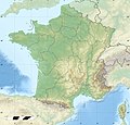
ಫೈಲ್:France relief location map.jpg

ಈ ಮುನ್ನೋಟದ ಗಾತ್ರೊ: ೬೨೪ × ೬೦೦ ಚಿತ್ರೊ ಬಿಂದುಲು. ಬೇತೆಪಟೊತ್ತ ಗಾತ್ರೊ: ೨೫೦ × ೨೪೦ ಚಿತ್ರೊ ಬಿಂದುಲು | ೪೯೯ × ೪೮೦ ಚಿತ್ರೊ ಬಿಂದುಲು | ೭೯೯ × ೭೬೮ ಚಿತ್ರೊ ಬಿಂದುಲು | ೧,೦೬೬ × ೧,೦೨೪ ಚಿತ್ರೊ ಬಿಂದುಲು | ೨,೦೦೦ × ೧,೯೨೨ ಚಿತ್ರೊ ಬಿಂದುಲು.
ಮೂಲೊ ಫೈಲ್ (೨,೦೦೦ × ೧,೯೨೨ ಚಿತ್ರಬಿಂದುಲು, ಫೈಲ್ದ ಗಾತ್ರೊ: ೯೦೭ KB, MIME ಪ್ರಕಾರೊ: image/jpeg)
ಫೈಲ್ದ ಇತಿಹಾಸೊ
ದಿನೊ/ಪೊರ್ತುದ ಮಿತ್ತ್ ಒತ್ತ್ಂಡ ಫೈಲ್ ಆ ಪೊರ್ತುಡು ಎಂಚ ತೋಜೊಂದಿತ್ತ್ಂಡ್ ಪಂದ್ ತೂವೊಲಿ.
| ದಿನೊ/ಪೊರ್ತು | ಎಲ್ಯಚಿತ್ರೊ | ಆಯಾಮೊಲು | ಬಳಕೆದಾರೆರ್ | ಅಬಿಪ್ರಾಯೊ | |
|---|---|---|---|---|---|
| ಇತ್ತೆದ | ೨೦:೩೧, ೧೯ ಅಕ್ಟೋಬರ್ ೨೦೧೭ |  | ೨,೦೦೦ × ೧,೯೨೨ (೯೦೭ KB) | Sting | No borders over the Lake of Constance |
| ೧೪:೧೪, ೩ ಜನವರಿ ೨೦೧೬ |  | ೨,೦೦೦ × ೧,೯೨೨ (೮೮೮ KB) | Jack ma | updated new administrative region boundaries 1/1/2016 | |
| ೧೮:೦೧, ೨ ಅಕ್ಟೋಬರ್ ೨೦೧೨ |  | ೨,೦೦೦ × ೧,೯೨೨ (೮೧೪ KB) | Palosirkka | Reverted to version as of 22:20, 17 July 2010 Location maps must remain very accurate | |
| ೧೪:೪೪, ೨ ಅಕ್ಟೋಬರ್ ೨೦೧೨ |  | ೨,೦೦೦ × ೧,೯೨೨ (೭೯೭ KB) | Palosirkka | Optimized with http://trimage.org | |
| ೦೩:೫೦, ೧೮ ಜುಲಾಯಿ ೨೦೧೦ |  | ೨,೦೦೦ × ೧,೯೨೨ (೮೧೪ KB) | Sting | Color profile | |
| ೧೯:೪೫, ೧೭ ನವಂಬರ್ ೨೦೦೯ |  | ೨,೦೦೦ × ೧,೯೨೨ (೮೨೨ KB) | Sting | Embedded sRGB profile | |
| ೧೮:೫೯, ೭ ನವಂಬರ್ ೨೦೦೮ |  | ೨,೦೦೦ × ೧,೯೨೨ (೮೦೧ KB) | Sting | + boundary for Channel Islands ; - canals | |
| ೨೨:೧೧, ೨೩ ಆಗೋಸ್ಟು ೨೦೦೮ |  | ೨,೦೦೦ × ೧,೯೨೨ (೮೦೩ KB) | Sting | Larger strokes for boundaries | |
| ೨೩:೨೮, ೨೫ ಜುಲಾಯಿ ೨೦೦೮ |  | ೨,೦೦೦ × ೧,೯೨೨ (೮೧೫ KB) | Sting | Variable scale | |
| ೨೦:೧೬, ೨೫ ಜುಲಾಯಿ ೨೦೦೮ |  | ೨,೦೦೦ × ೧,೯೨೨ (೮೧೪ KB) | Sting | - border |
ಫೈಲ್ದ ಉಪಯೋಗ
ಈ ತಿರ್ತ್ದ ಪುಟೊ ಈ ಫೈಲ್ಗ್ ಸಂಪರ್ಕೊ ಕೊರ್ಪುಂಡು.
ಜಾಗತಿಕೊ ಫೈಲ್ ಉಪಯೋಗೊ
ಈ ಫೈಲ್ನ್ ತಿರ್ತ್ ಉಪ್ಪುನ ಬೇತೆ ವಿಕಿಲು ಗಲಸುವ:
- als.wikipedia.org ಮಿತ್ತ್ ಉಪಯೋಗೊ
- Grosser Belchen
- Donon
- Vorlage:Positionskarte Frankreich
- Planche des Belles Filles
- Vorlage:Positionskarte Frankreich Haut-Rhin
- Vorlage:Positionskarte Frankreich Bas-Rhin
- Vorlage:Positionskarte Frankreich Saône-et-Loire
- Vorlage:Positionskarte Frankreich Paris
- Vorlage:Positionskarte Frankreich Territoire de Belfort
- Vorlage:Positionskarte Frankreich Essonne
- Vorlage:Positionskarte Frankreich Pyrénées-Orientales
- Vorlage:Positionskarte Frankreich Pas-de-Calais
- Vorlage:Positionskarte Frankreich Normandie
- Vorlage:Positionskarte Frankreich Orne
- Vorlage:Positionskarte Frankreich Île-de-France
- Vorlage:Positionskarte Frankreich Nord
- Vorlage:Positionskarte Frankreich Moselle
- Vorlage:Positionskarte Frankreich Morbihan
- Vorlage:Positionskarte Frankreich Maine-et-Loire
- Vorlage:Positionskarte Frankreich Pays de la Loire
- Vorlage:Positionskarte Frankreich Loire-Atlantique
- Vorlage:Positionskarte Frankreich Isère
- Vorlage:Positionskarte Frankreich Ille-et-Vilaine
- Vorlage:Positionskarte Frankreich Okzitanien
- Vorlage:Positionskarte Frankreich Gard
- Vorlage:Positionskarte Frankreich Korsika
- Vorlage:Positionskarte Frankreich Corse-du-Sud
- Vorlage:Positionskarte Frankreich Nouvelle-Aquitaine
- Vorlage:Positionskarte Frankreich Dordogne
- Vorlage:Positionskarte Frankreich Bretagne
- Vorlage:Positionskarte Frankreich Finistère
- Vorlage:Positionskarte Frankreich Côtes-d’Armor
- Vorlage:Positionskarte Frankreich Bourgogne-Franche-Comté
- Vorlage:Positionskarte Frankreich Alpes-Maritimes
- Vorlage:Positionskarte Frankreich Provence-Alpes-Côte d’Azur
- Vorlage:Positionskarte Frankreich Alpes-de-Haute-Provence
- Vorlage:Positionskarte Frankreich Allier
- Vorlage:Positionskarte Frankreich Hauts-de-France
- Vorlage:Positionskarte Frankreich Aisne
- Vorlage:Positionskarte Frankreich Auvergne-Rhône-Alpes
- Vorlage:Positionskarte Frankreich Ain
- Vorlage:Positionskarte Frankreich Grand Est
- Vorlage:Positionskarte Frankreich Ardèche
- Vorlage:Positionskarte Frankreich Calvados
- Vorlage:Positionskarte Frankreich Cantal
- Vorlage:Positionskarte Frankreich Charente
- Vorlage:Positionskarte Frankreich Centre-Val de Loire
- Vorlage:Positionskarte Frankreich Charente-Maritime
- Vorlage:Positionskarte Frankreich Haute-Corse
- Vorlage:Positionskarte Frankreich Eure
ಈ ಫೈಲ್ದ ನನಾತ್ ಜಾಗತಿಕ ಉಪಯೋಗೊನು ತೂಲೆ.


